

Outdoor: a hiking map
for MapLibre.
Trails coloured by difficulty, via ferratas, huts, stops and drinking water, peaks with their height, contour lines and hillshading, worldwide. One style URL for MapLibre GL JS, with the trails from the live OpenStreetMap data of our Overpass server.
- 100'000 map tiles a month free
- 3D terrain with one parameter
- Labels in 41 languages
What the map shows
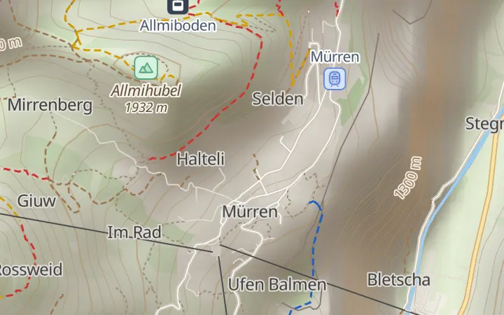
- Hiking trails by their SAC grade, in the colours of Swiss signposts: yellow for hiking trails (T1), red for mountain trails (T2 and T3), blue for alpine trails (T4 to T6). Paths without a grade are grey. Graded trails show from zoom 11.
- Tracks, via ferratas, cable cars and ski lifts.
- Huts, campsites and viewpoints; train stations, bus and tram stops, cable car stations and ferry terminals; drinking water and springs.
- Peaks with their height in metres, rock, cliffs, glaciers, forests and meadows.
- Contour lines from zoom 10 and hillshading, from the Copernicus 90 m terrain.
The trails, stops and water points come from the live OpenStreetMap data of our Overpass server, and a tile is at most 7 days old. The rest of the map is updated every week.
Add it to your page
<link rel="stylesheet" href="https://unpkg.com/maplibre-gl@6.13.0/dist/maplibre-gl.css">
<div id="map"></div>
<script type="module">
import * as maplibregl from "https://unpkg.com/maplibre-gl@6.13.0/dist/maplibre-gl.mjs";

const map = new maplibregl.Map({
  container: "map",
  style: "https://api.overpass.ch/v1/YOUR_KEY/maps/styles/outdoor.json",
  center: [7.96, 46.6],
  zoom: 13
});
map.addControl(new maplibregl.NavigationControl({ visualizePitch: true }));
</script>
?terrain=1adds 3D terrain; tilt the map withpitchand allow up to 85 degrees withmaxPitch: 85.?lang=desets the label language; 41 languages are available, and places without a name in that language show their local name.- Give the
#mapelement a height in your stylesheet.
More in the guides: a hiking map in MapLibre, with trail popups and your own route, 3D terrain and contour lines. Endpoints and layers are in the documentation.
What to expect
- The grade of a trail is what OpenStreetMap mappers entered. Many paths have none, and a grade can be out of date. The map helps to plan a tour; it does not replace a guidebook, the signposts or your judgement.
- Contour lines and terrain come from a grid with 90 m spacing. Summits read lower than they are: the Matterhorn shows 4,210 m instead of 4,478 m.
- The style uses a second set of icons and needs MapLibre GL JS; other libraries may show the map without them.
- Every tile counts once: vector tiles, trails, contour lines and terrain. The first view, 1280 × 720 pixels at zoom 13, loads about 20 tiles; 3D views load more.
Maps plans
Every account includes 100'000 map tiles a month, for every style. Maps Small has 2 million for CHF 9 a month. How that compares.
Maps Free
- Map tiles / month100'000
- Map tiles / minute1'200
- Elevation lookups / month1 million
- Commercial use
- World map, updated weekly
- Our outdoor, marine, relief and driving styles
- 5 Protomaps styles, labels in 41 languages
- 3D terrain, hillshading, contour lines
- Elevation API included
- No e-mail support
Maps Small
- Map tiles / month2 million
- Map tiles / minuteUnlimited
- Elevation lookups / month50 million
- Commercial use
- World map, updated weekly
- Our outdoor, marine, relief and driving styles
- 5 Protomaps styles, labels in 41 languages
- 3D terrain, hillshading, contour lines
- Elevation API included
- E-mail support
Maps Medium
- Map tiles / month10 million
- Map tiles / minuteUnlimited
- Elevation lookups / month200 million
- Commercial use
- World map, updated weekly
- Our outdoor, marine, relief and driving styles
- 5 Protomaps styles, labels in 41 languages
- 3D terrain, hillshading, contour lines
- Elevation API included
- Priority e-mail support
Maps Large
- Map tiles / month40 million
- Map tiles / minuteUnlimited
- Elevation lookups / month500 million
- Commercial use
- World map, updated weekly
- Our outdoor, marine, relief and driving styles
- 5 Protomaps styles, labels in 41 languages
- 3D terrain, hillshading, contour lines
- Elevation API included
- Priority support
Our four styles
Outdoor
Trails by SAC grade in the Swiss colours, huts, stops, drinking water, peaks with their height and contour lines.
Marine
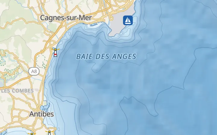
The sea coloured by depth, depth contours, lighthouses, buoys and beacons in their colours, harbours and ferry routes.
Relief
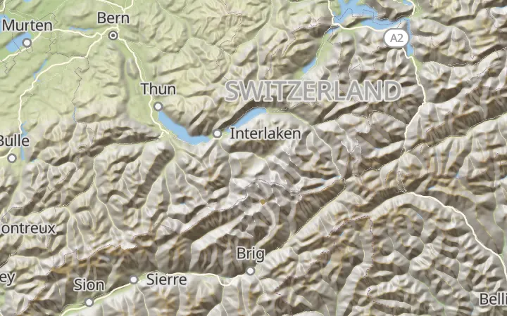
The land coloured by height, from green lowlands to rock and snow, with hillshading and contour lines.
Driving
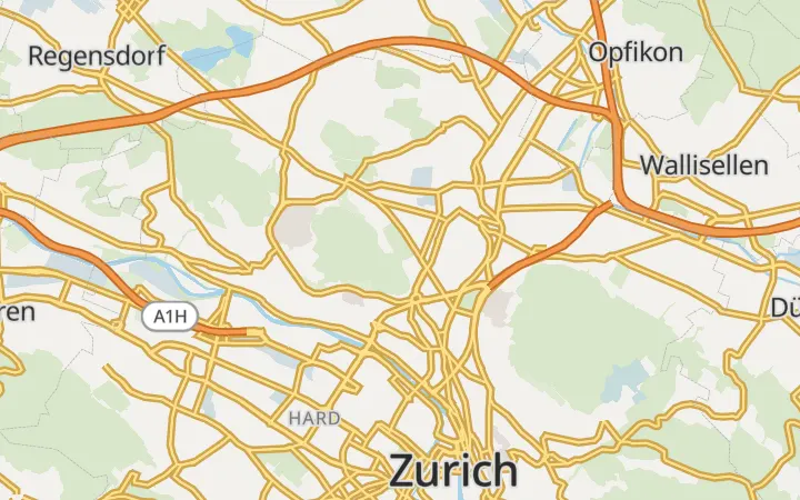
Wide, clear roads with motorway numbers, fuel stations, charging stations and car parks.
Pictures: © OpenStreetMap contributors · Protomaps · Copernicus WorldDEM™-90 © DLR, Airbus · GEBCO
Map data © OpenStreetMap contributors. Style based on Protomaps. Terrain: Copernicus WorldDEM™-90 © DLR e.V., © Airbus Defence and Space GmbH, provided under COPERNICUS by the European Union and ESA. The style shows these credits in a corner of the map; keep them visible.